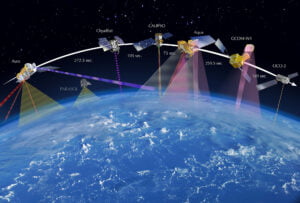
Remote Sensing is divided into two types. Active Remote Sensing and Passive Remote Sensing. Remote Sensing is the process of acquiring information about the physical characteristics of the Earth’s surface without having to directly get in contact with the environment. Based on the source of the radiation emitted to collect information, the remote sensing is classified as
- Active Remote Sensing
- Passive Remote Sensing
Active Remote Sensing
Active Remote Sensing emits its own energy in order to scan the object and areas and has a sensor that detects the emitted radiation that got reflected from the target environment. Active remote sensing sensors such as RADAR, LiDAR are some of the important sensing equipment where radiation is emitted and the return time is measured in order to detect the speed and direction of the object and environment.
Active Remote Sensing Example
RADAR
Radar is a short form of radio detection and ranging. Besides, it’s a communication that uses waves to identify and pinpoint objects. Initially, it was used by ship captains to communicate with their agencies’ radio towers. With time, they noticed that objects in towers and the craft caused interruptions hence preventing effective communication. Therefore, what began as an inconvenience progressed to new defense strategies for water and the land and the sky.

LiDAR
LIDAR stands for Light Detection and Ranging. It is used in generating 2d and 3d maps of the environment primarily by using two measurement techniques, TOF ( Time Of Flight } and Laser Triangulation. Though lidar can be used for many applications, its primary use case is in autonomous vehicles for generating a 2d or 3d map of their environment and using the generated map to Localise ( Finding where the vehicle is by comparing with the generated map ) and navigate to the destined location.

Application of Active Remote Sensing
Mapping
Radar Mapping is used to map the Earth’s Surface used in the creation of the High-Resolution Digital Elevation Models ( DEMs ) and identification of topographic features such as Mountains, valleys etc. Since radars can penetrate clouds, it can be used in any weather to map large areas.
Agriculture
Synthetics Aperture Radar ( SAR ) can penetrate through vegetation and provide information on crop type, growth stage and moisture levels. Thus this data is used in farming to optimise irrigation and also provide information on optimal use of fertilisers and pesticides.
Land Classification
LiDARs are used in land cover classification. The laser pulses that emitted from LiDAR takes time to hit and bounce off of the Earth’s surface. This is noted and used in calculating the detailed 3D image of the terrains and building. This method is extremely useful in environment monitoring, city planning and forestry.
Atmospheric Studies
In Atmospheric studies, LiDAR systems and Doppler Radar systems are used to measure distribution of clouds, aerosols and pollutants in environment and provide data on weather, storm tracking etc.
Passive Remote Sensing
Passive Remote Sensing, unlike active sensing, does not emit any energy to read the reflection data. The Passive Remote sensing uses Sensors that reads the radiation that is emitted or reflected by the environment. Most of the time, the radiation is the Sun’s radiation. Thus this method doesn’t use any active emitters, this is called Passive Remote Sensing.
Example of Passive Remote Sensing
Optical Image
Cameras and multispectral/hyperspectral imagers captures visible light and infrared radiations to create High-Resolution images which can be used in various applications such as mapping, vegetation analysis and environmental monitoring.

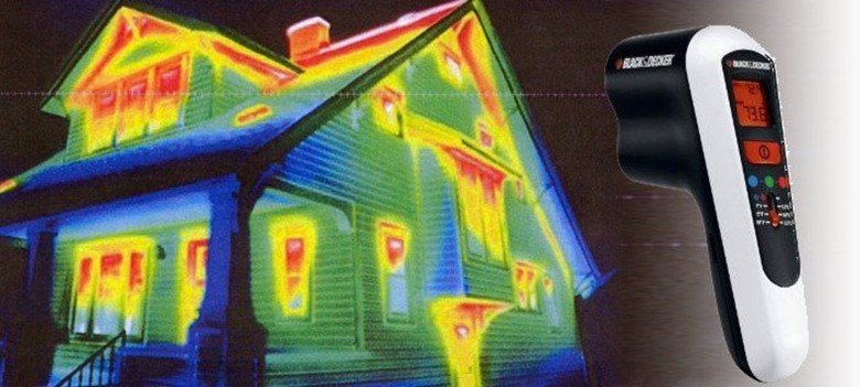
Thermal Imaging
Thermal imaging uses IR cameras which measure the radiations emitted from objects based on their temperature and provide information about surface temperature, heat distribution and other anomalies.

Radiometer
Radiometer measures the radiation that occurs naturally across different wavelengths. This is used in measuring climate and atmospheric data of the Earth.
Application of Passive Remote Sensing
Vegetation Analysis
Passive Remote Sensing is used in monitoring vegetation helath and biomass estimation by analysing the reflectance property of crops in different spectral bands.
Environmental Monitoring
In Environmental monitoring, factors like water quality, errosion, deforestation and land degradation can be measured with the help of passive remote sensing.
Disaster Monitoring
Valuable infromations such as natural disasters, floods, wildfire and earthqueakes can be detected with the help of passive remote sensing.
Oceanography and Coastal Studies
Passive sensing is extensively used in studying oceans and coastal data. It helps in monitoring sea surface temperature, chlorophyll concentrations, sea surface heights and ocean current.
Conclusion
In conlcusion, Remote Sensing is a powerful tool to collect information aboutn the Earth’s surface from a distance. It can be categorized to two types, Active Remote Sensing and Passive Remote Sensing.
Active Remote Sensing emitts the energy and detects the reflected radiation from the object to detect its position and types of the material and its size. Whereas Passive Remote sensing doesn’t have any radiation source and relies on the radiation from the Sun in most cases or naturally occuring radiation from Earths surface to detect and map the environment.
Both active and passive remote sensing plays an important role in understanding and monitoring our Earth’s atmosphere and its environment.


Pingback: Satellites in Remote Sensing: Working and Its Types - LIDAR and RADAR
Pingback: 19 Applications of GPS ( Global Positioning System ) - LIDAR and RADAR
Pingback: GPS vs GLONASS vs Galileo - LIDAR and RADAR
Pingback: Types of Resolution in Remote Sensing : Explained. - LIDAR and RADAR