Navigation in today’s today’s world has become an integral part of our daily life. From agriculture to aviation, navigation systems are used in parts where it is not even imagined. Global Navigation Satellite Systems ( GNSS ) have contributed in this growth but there is a technology that can increase the performance of GNSS that is known as the Satellite Based Augmentation Systems ( SBAS ).
How SBAS Enhances GNSS performance
The concept behind SBAS is simple, yet transformative. To Augment the accuracy and reliability of GNSS signals, SBAS acts as a regional error correction system, refining the GNSS data by correcting the measurement of errors and providing valuable information about accuracy, integrity, continuity and signal availability.
By nature, GNSS provides location and timing information by using the signals from the networks of satellites in the Earth orbits. Then these signals can be prone to errors that are caused by the atmospheric conditions, orbits and other such factors.
These errors can be rectified with the help of the SBAS systems. To achieve this, the accurate location of the reference stations are placed strategically all over the continent. These stations then collect GNSS measurements and send the data to the computing centers. At this hub, differential corrections are calculated and integrity messages are generated. These correction codes are then broadcasted to the respective areas using geostationary satellites. Thus augmenting over the original GNSS signals.
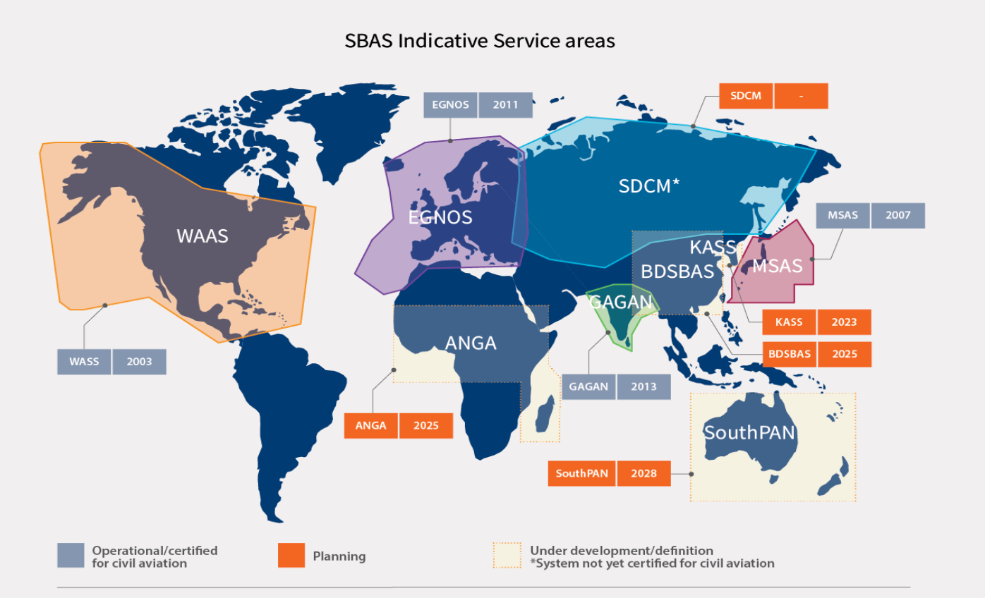
SBAS implementations and coverages
The SBAS technology has led to the creation of several systems. One of the notable systems in the European GeoStationary Navigation Overlay Service ( EGNOS ), which covers the majority of the EU and its neighboring regions. Similar systems are also developed by various countries to achieve common global standards for ensured compatibility and interoperability. Below are the systems developed by each countries,
- United States: Wide Area Augmentation System ( WAAS )
- Japan: Michibiki Satellite Augmentation System ( MSAS )
- India: GPS-Aided GEO-Augmented Navigation ( GAGAN )
- China: BeiDou SBAS ( BDSBAS )
- South Korea: Korea Augmentation Satellite System ( KASS )
- Russia: System for Differential Corrections and Monitoring ( SDCM )
- Africa: Augmented NaviGation for Africa ( ANGA )
- Australia and New Zealand: Southern Positioning Augmentation Network ( SouthPAN )

All these systems have a common global standard, ensuring that each of them do not interfere with one another, so that the users with common receivers get a consistent and reliable level of service.
SBAS Applications: Beyond Aviation
SBAS systems have a range of applications, below are some list of it,
- Precision Farming
- Fleet Management
- Geodesy and Surveying
- Disaster Management
- Marine Navigation
- Construction and Infrastructure
- Resource Exploration
- Environmental Monitoring
- Search and Rescue Operations
- Telecommunications Infrastructure
- Mapping and Cartography
- Scientific Research
ICAO Standards and SBAS
The International Civil Aviation Organization ( ICAO ) is a SBAS standardizing organization which plays an important role in SBAS for aviation. The organization’s Standards and Recommended Practices (SARPs) Annex 10 gives guidelines for SBAS implementation in aviation. These guidelines have evaluation criteria like accuracy, integrity, service continuity and availability. The concept of Approach with Vertical Guidance ( APV ) is a concept created with ICAO’s standard which ensures the vertical guidance during approaches.
Interoperability Of SBAS
The main strength of SBAS is its interoperability. The Interoperability Working Group ( IWG ), consists of the SBAS providers globally, who take care of the coordinated development and interoperability of the SBAS systems and the aircraft avionic technologies. This ensures that the aircrafts can seamlessly move between different SBAS systems when during a inter continental flights and maintain safety and efficiency globally.
Conclusion
Satellite-Based Augmentation Systems ( SBAS ) ensure the efficient and reliable navigation data for its users by using its several ground stations. There are several governing bodies that monitor the development of these SBAS systems and its advancements to ensure that the global service is standardized and provides a stable and robust infrastructure for its users.